
The Icefields Parkway winds through the Canadian Rockies, connecting Banff and Jasper National Parks. We stopped at many viewpoints and did several short hikes off this scenic road when we visited in September.
At Bow Summit we hiked up a trail about 15 minutes to get an excellent view of Peyto Lake.
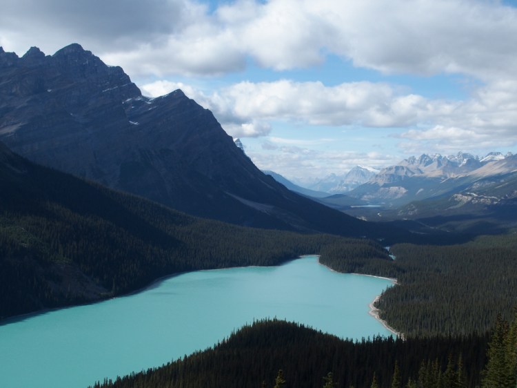
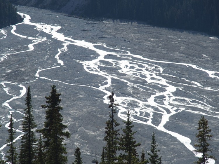
Looking in the opposite direction from that same viewpoint, Peyto Creek beautifully squiggled across an alluvial fan before reaching the lake.
A group from a tour bus arrived at the Peyto Lake viewpoint shortly after us. They wasted no time taking hundreds of selfies. Five minutes later they were gone. It was pretty comical actually.
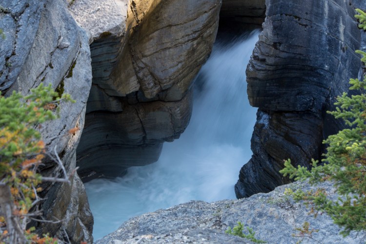
Our next short hike took us to Mistaya Canyon. Here the Mistaya River transitions from flowing through a valley into a deep gorge.

A bridge crosses the deep narrow canyon, allowing people to view the rushing waters below. It’s very impressive in person, but difficult to capture on film.
After leaving the canyon, we found a first-come, first-served campsite at Rampart Creek, ate a simple yet tasty dinner, and called it a night.
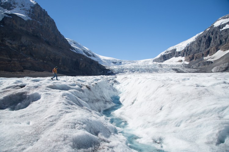
The next morning we visited the Columbia Icefield Centre. There we bought tickets to ride their special bus onto the Athabasca Glacier. After a short bus ride, we found ourselves standing on the glacier. It was really cool. We’ve crossed lots of snow while hiking, and seen glaciers in the distance, but standing on this highly compacted blue ice was a new experience for us.
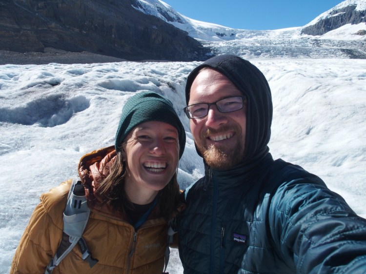
We couldn’t go far from the bus, but it was fun to take pictures and wander a bit.

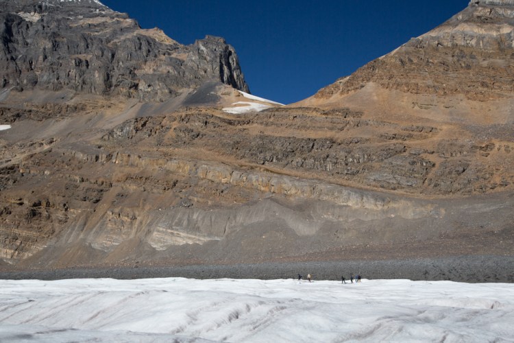
This other group of travelers really gives the landscape proper scale.
Back on the Icefields Parkway, we drove north to Sunwapta Falls. The river rushed along either side of this small island before cascading down.
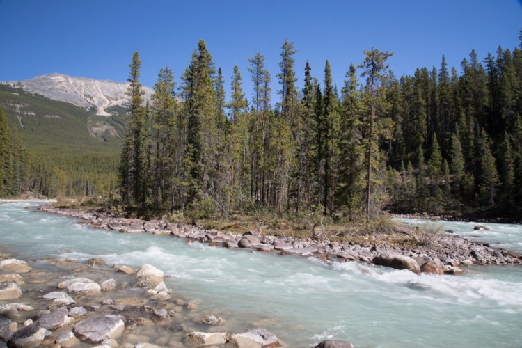
The Icefields Parkway continued to wind through beautiful country, with countless vistas, rivers, and turquoise lakes. We especially enjoyed eating a snack at this unnamed pull off. We had it all to ourselves, a treat along this popular route.

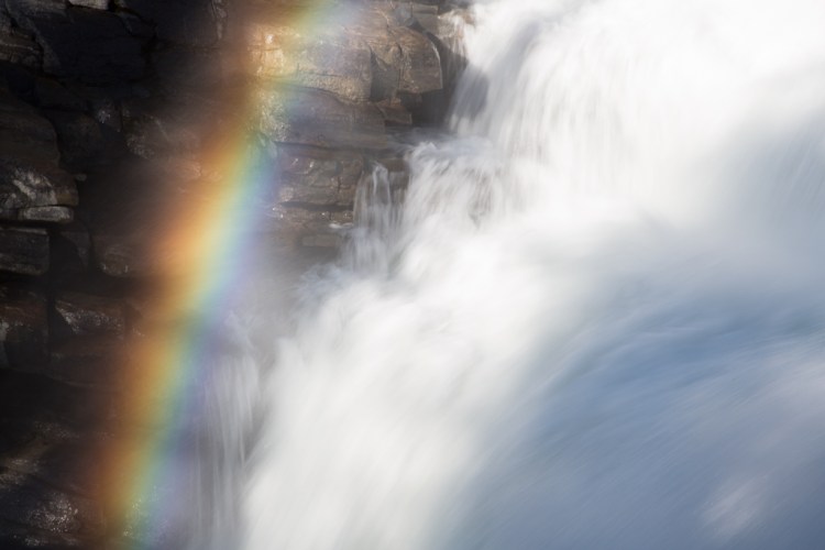
We stopped at Athabasca Falls next. The trail offers several vantage points.
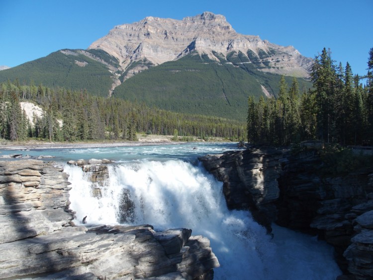
The light wasn’t ideal for a photo of the entire falls (above), but it did make some nice rainbows in all the spray.
We wandered down a side trail, which was less crowded than the falls area. It led us through an old channel that the falls had previously carved.

We ended up on a rocky beach. Minutes ago, water rushed violently over the falls and through the canyon. Now the flow had space to spread out and calm down.

Our last task was to find a campsite for the evening. It proved more difficult than expected as several campgrounds were entirely full, or had closed in early September for the season. We eventually found an open spot at the Snaring River Campground north of Jasper. It was time to sleep and regain our energy for another day of adventure in the Canadian Rockies.

Wow, lovely photos, especially the one of the “other group of travelers”. I really need to get to Banff.
LikeLike
We need to get back there this summer again. Great memories.
LikeLike
Gorgeous! What was that special bus like?
LikeLike
Sooooooo beautiful!
LikeLike