Earlier Start, New Home City, and Permits

We’ve decided to start hiking a bit earlier than we originally planned, for a few reasons. The early start will allow us to walk fewer miles in the beginning of the trip and more gradually increase our pace. It has been a very low snow year for California, so starting a week early shouldn’t cause any snow challenges. Also, we finished our tour of possible new cities (more thoughts on that below). Finally, as you might guess, we’re antsy to hit the trail. Our new plan is to start hiking north from the US/Mexican border on April 19th. That’s less than a week from now!

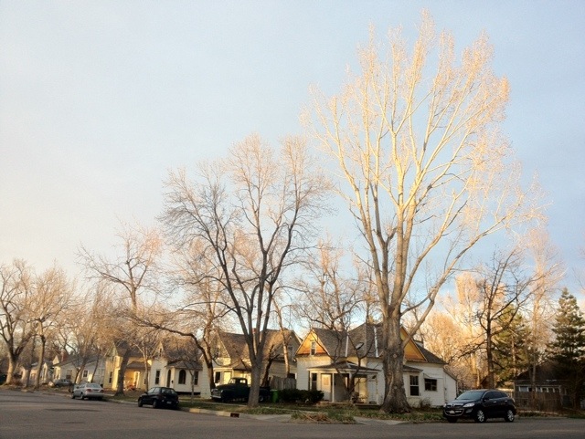
We had a great tour of potential cities to live in after we finish the hike. Each place had its own unique feel and culture, and we’re glad we took the time to explore them firsthand. The place that clicked with us best was Fort Collins, Colorado. The friendly, down to earth people, good bike lanes, lively walkable downtown, proximity to the mountains, and art scene were all major positives for us. We are very excited to call Fort Collins our new home after hiking the PCT!

Sunset in the Old Town area of Fort Collins

Although we just picked a new home city, the woods and mountains of the Pacific Crest Trail will be our home for the next five months. We received our permits from the Pacific Crest Trail Association (PCTA) allowing us to camp anywhere along the trail. We are very grateful to the PCTA for coordinating with the many National Park, State Park, and Forest Service organizations to make this permit process so simple.

PCT Training in Canyonlands National Park

We figure the best way to train for thru-hiking the Pacific Crest Trail, is, surprise, surprise, to go backpacking. After checking out Salt Lake City and before heading to Fort Collins, we spent six days backpacking in Canyonlands National Park, in Utah. We covered almost the entire Needles District of the park, camping at Chesler Park 4, Elephant Canyon 1, Lost Canyon 1, Salt Creek 4, and Salt/Horse, and exploring  several side trails as well.

Canyonlands is one of the few completely silent places we’ve ever been. It is amazing, and a bit unsettling, to listen intently and hear absolutely nothing – no human sounds, no natural sounds – just utter silence. In a space devoid of sound, you begin to notice your breathing and your heartbeat. In the morning, the occasional bird call echoes through the canyons, which is quite beautiful as it breaks through silence and fades back into it.

The Big Dipper between two needles

We didn’t encounter many other hikers here. For the most part, we had the massive, often otherworldly landscape all to ourselves. This added to the intensity of the experience, which was personal and powerful.

A few of my favorite maps

Good maps are essential. We plan to use two types of maps on our thru-hike, plus a third map type to keep folks at home informed about our location.

Paper maps

As a public service, a hiker named Half Mile has created a wonderfully detailed set of topo maps covering the entire Pacific Crest Trail. The maps include terrain, notes, and points of interest like campsites, post offices, and water sources. The route of the PCT is well-marked on the maps, as are side trails. Elevation profiles are placed at the end of each section. Check out Half Mile’s website to download free PDF files of the maps. We had the maps printed double-sided (less paper to carry) on a color laser printer (they won’t smear if wet). We’ll send ourselves the appropriate map sections in our food boxes, so we won’t have to carry them all at once.

A Half Mile map page with notes

Even if you have a GPS, it’s important to carry a paper map and compass as a backup. The GPS might fail, and it can lose its view of the sky in steep canyons or dense forests. If you don’t know how to read a topo map or take a bearing with a compass, orienteering is a fun way to learn!