Death Valley National Park Day Hikes

Death Valley is home to incredibly varied and beautiful landscapes. In our last post we wrote about its most famous viewpoints and easily accessible spots. In this post, we share day hikes, some of which are in less-visited areas of the park.

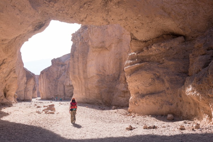
Natural Bridge Canyon is a short hike featuring a large natural bridge. It’s an easy way to experience one of Death Valley’s many canyons, which provide endless nooks and crannies to explore.

Anna walks under the natural bridge.
Once past the bridge, the number of hikers quickly drops off, and you have the canyon almost completely to yourself. There’s a boulder to squeeze under and a small pouroff to scramble up before you reach the larger dryfall that ends the trail.

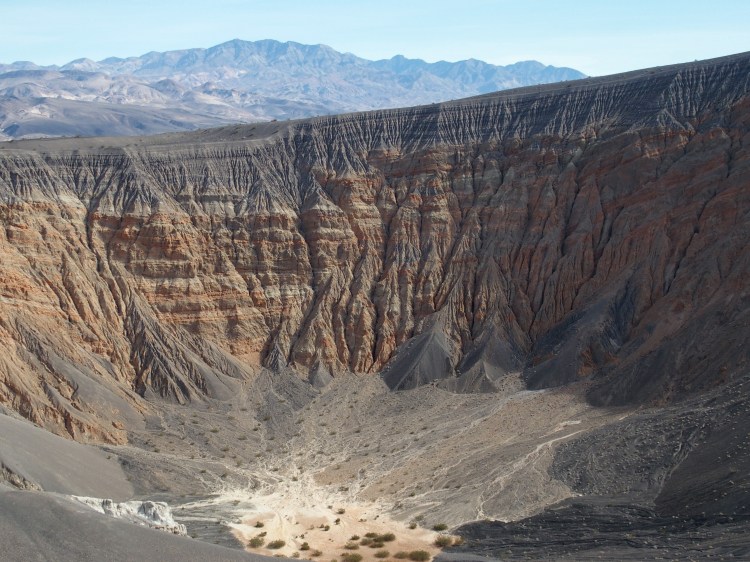
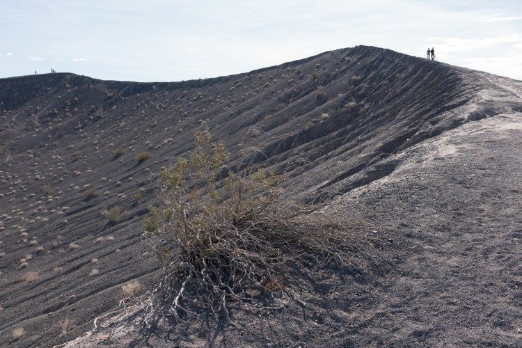
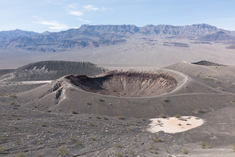
Ubehebe Crater is a volcanic spectacle half a mile wide and 700 feet deep. You can walk the rim of the crater, then follow the trail over to Little Hebe.

Ubehebe Crater
Walking around the rim of the crater
Little Hebe Crater as viewed from Ubehebe

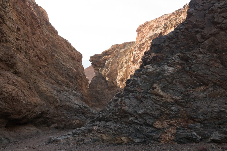
Mosaic Canyon provides a winding tour of unusual geology. The entire trail is 4 miles, but you don’t have to hike the whole thing to enjoy plenty of beautiful rock.

Classic Death Valley National Park Views

When you think of Death Valley National Park, you are probably envisioning Badwater Basin. It’s extremely dry and one of the hottest places in the world.

So that’s why we decided to visit in January! We experienced highs in the 70s, well below the 110+ degree heat you can expect in the summer months. The record temperature in Death Valley is a blistering 134 degrees!

We attended an excellent ranger talk at Badwater. Check out this program or any ranger talk at your next national park. They are consistently fun, informative, and great for all ages.

Badwater Basin is the lowest point in North America
Badwater got its name from a traveler literally writing “bad water” on a map. The water here is too salty to drink.
Salt flats at Badwater Basin

There is so much more to the park than Badwater though.

Day 2-4: Easing In

Day 2: Mile 11- past Lake Morena to mile 26; 15 miles
Day 3: Mile 26 – 36; 10 miles
Day 4: Mile 36 – 45.5; 9.5 miles plus Mt. Laguna town resupply

The first stretch of the PCT from the Mexican border to Mt. Laguna has been great. We are seeing beautiful landscapes, observing interesting wildlife, getting our legs accustomed to our pack weight and daily mileage, and meeting friendly people.

20120422-163904.jpg

The scenery tends to be low shrubs covering rolling hills with occasional wildflowers interspersed.

20120422-164118.jpg
However, there are plenty of exceptions. Stands of large oak trees grow near creeks, some sections have rocky outcrops, and as we gained elevation near Mt Laguna we entered a pine forest. One of our favorite spots was near a big oak tree that looked to be hundreds of years old. Old trees have a calming but powerful presence and we really enjoyed that campsite.