

Our Pacific Crest Trail gear review continues. This time we’ll talk about our electronic gadgets, many of which helped us update this blog while hiking.

Smartphone = Apple iPhone 4S 4.8 oz. Our phones were the most versatile items we carried on our thru hike. They enabled us to check our location, view the latest water, fire, weather, and trail condition reports, take notes, update this blog from the trail, learn about our surroundings, and talk with friends and family.
We protected our phones from knocks with Incipio cases. On rainy days, we operated them through waterproof Aloksaks. Because we were careful with them, our phones were none the worse for wear after 2600 miles, and we will definitely be carrying them on the Appalachian Trail.
Apps = Here are the apps we used most frequently on the PCT:

- Topo Maps. Before the hike, we used this app to download every USGS quad the PCT passed through. We also imported all of Half Mile’s PCT waypoints into the app. On the trail, we opened the app to view our exact position, the trail’s path marked in half mile increments, the next water source, and the surrounding terrain. The combination of Half Mile’s highly accurate data with the Topo Maps app was awesome. There’s a reason Anna received the name North Star — she always knew where we were! To learn more about the app, read our blog post about maps.
- PCTHYOH. This free app features PCT water reports, local weather forecasts, fire reports, useful phone numbers, and more. It downloads the latest information on command, and caches everything so it’s viewable without a cell phone signal. We used it frequently, and had the pleasure of meeting its creator in Yosemite’s Tuolumne Meadows. Well done, Ruffwork!

Editing in the WordPress app - WordPress. We uploaded blog posts with this app. It is decent, but has some rough edges, and the offline mode is lacking.
- Notes. We used this built-in iPhone app to jot down all kinds of information. No need for pen and paper.
- AutoStitch. When a standard photograph was too narrow, we used this app to combine multiple iPhone images into a panorama. AutoStitch takes time to stitch images, but the resulting photo is higher quality than other panorama apps can produce.
- GPS Tracker. When we had a cell signal, we updated the Tracking page on the blog with this app. It was a simple way for people to follow our progress, including some kids who learned a lot about geography by watching our dot move along the trail. Note: We will re-enable the Tracking page when we start hiking the AT in March.

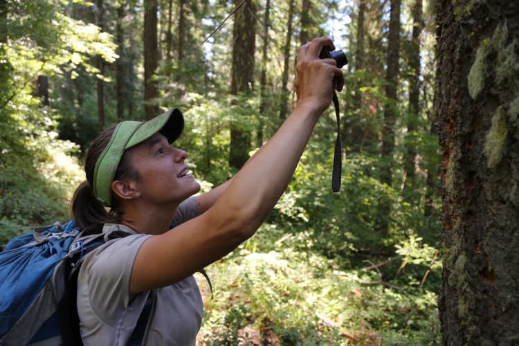
Viewing a bird in iBird PRO - iBird PRO. This is best nature guide app we’ve used. Not only are there photographs, maps, and a good search feature, the app includes recordings of bird calls.
- MyNature Tree Guide. The interface is poor, making it slow and sometimes impossible to identify trees. This app is better than nothing, but we hope someone creates a better option.
- MyNature Tracks. This app helps identify tracks and scat, but the search function is cumbersome. Recently the author added better pictures, a big improvement.
- CAWildflower. A nicely color-coded guide to California wildflowers. We used it to learn the names of many flowers along the PCT.
Headlamp = Petzl e+LITE headlamp 1.0 oz. This tiny LED headlamp provided plenty of light for use in camp. It was reliable and we only replaced the batteries once on our 5.5 month trip. A beefier headlamp would be best for night hiking, but for our purposes the e+LITE was perfect.
North Star’s camera = Canon S90 7.0 oz. The S90 (now improved and called the Canon S110) is a pocket size camera which provides outstanding image quality and a solid zoom range. About one third of the images on this blog came from the Canon S90. North Star carried the camera in her waterproof hip belt pocket for easy access. We used an AirStash to transfer images from the camera to an iPhone for blogging. We were impressed not just by the image quality and small size of the S90, but also by its durability. It survived our thru hike without issue.
 Shutterbug’s camera = Canon 5D Mark III with 24-105L lens 3.6 pounds. This camera has a large sensor with very low noise, high dynamic range, and superb image quality. The 5D features a full complement of manual controls and is weather sealed against dust and rain. The lens is also weather sealed, and it’s image-stabilized, creating sharp images in low light without a tripod. Shutterbug carried the camera in a Think Tank Digital Holster 20 on his backpack’s hip belt, giving him easy access. As with the Canon S90, we we used the AirStash to transfer images from the 5D to our iPhones. For Shutterbug the 5D and 24-105L lens were worth their weight, delivering beautiful images suitable not just for the blog, but also for our PCT photo book and to make very large prints.
Solar Panel = Suntactics sCharger-5 solar panel 8 oz. We used this 5-watt panel all the way from Mexico to Canada, with great results. In bright sun, it could fully charge one of our iPhones in 2 hours, and it’s lighter than other comparable panels. We drilled holes in the corners so we could attach it to our packs and charge as we walked. To charge North Star’s camera battery, we connected the panel to a Universal Battery Charger Adapter. The sCharger-5 was one of our favorite pieces of gear on the thru hike because it was simple, reliable, and provided endless renewable energy.


Sounds good but, as when reading Tramplite’s article on recharging equipment while cycling, I can’t help wondering how much data costs on the trail. Somehow, I got charged £10 for data when I went across to England even though I had tried switching everything off. Clearly, you didn’t find the costs prohibitive.
LikeLike
We didn’t incur any additional charges, just our standard monthly data plan charge while in the US. After crossing into Canada there was an additional international data plan fee.
LikeLike
Thanks guys for your review! Questions: did you use at all any paper prints of Halfmile maps? Did you have any copy in case the iPhone went over and out for some reason?
I see that you have a Verizon mobile subscription. Would you recommend that provider over others? Or you just had it because it was your provider from before the trail?
Cheers from Auckland, down under :)
LikeLike
Yes, we used both Half Mile’s waypoints in the Topo Maps app and his data in printed form. The waypoint files were handy for checking our exact position. For example, if you reach a slow trickling stream close to where you expect water, the GPS waypoints can let you know if indeed you are at the marked water source or if you are still 1/4 mile from the source which will be flowing stronger. The paper maps are nice as you mentioned in the event of a phone failure. Plus, the paper maps provide more detail than the waypoint names, i.e. “WA1712 stream 200 ft west”, rather than just “WA1712”.
Regarding the best carrier, I can’t give a definitive answer. Verizon phones had reception some places AT&T didn’t, but at other times AT&T had reception when Verizon had none. In the Sierras and Washington there were long stretches without signal and we had to track down wifi connections in the small towns.
Hope you’re enjoying New Zealand! Look forward to seeing your pics on Facebook.
LikeLike
i remember seeing a steller jay when I visited the grand canyon as a teen ager, of course I wont say how long ago that was!
LikeLike
Nice! It’s fun to catch a glimpse of their brilliant blue wings in the trees.
LikeLike
I use the GoalZero Nomad 7 solar panel/charger. Are you familiar with it? How would you compare it to what you used if you are familiar with it? Thanks.
LikeLike
We saw a few people using the Goal Zero Nomad 7 on the PCT. They seemed to like it. We prefer the Suntactics sCharger-5 solar panel because it is lighter, smaller, and produces a similar amount of power.
LikeLike
Did you charge directly to your iPhone? WIth the GoalZero the iPhone is too finicky to go direct so I have to charge a battery pack which then can charge the phone, which is nice to have power in reserve regardless of solar offerings, but it’s more weight.
LikeLike
Yes, we charged our iPhones directly from the Suntactics panel without an intermediate battery pack. As you mention, this saves weight.The iPhone’s built-in battery has a high capacity, and we usually keep the phone in airplane mode, saving power. If the forecast predicted rain or clouds we used the solar panel to top the internal iPhone batteries off at 100%.
LikeLike
Part of my “problem” is that I like to run “GPS KIT” constantly to gather my hiking stats including distance. Running the GPS non stop during the day isn’t exactly a battery conservation tactic. :-)
LikeLike
Would you recommend the Suntactics sCharger5 for a solo thru hiker? I like the fact it doesn’t have a “distributor” battery pack. I’m asking because maybe a smaller one would be more adequate for me.
I’m getting ready for the PCT this year!
LikeLike
If you carry a smartphone and use it frequently, especially for blog posts, the sCharger 5 is perfect. If you only use your phone occasionally you might not need the amount of power the sCharger 5 provides. We haven’t tried any of the smaller solar panels so we can’t really comment on those. Have an awesome hike!
LikeLike
Last summer while hiking in the Sierras I carried my iphone 4. I also carried my Garmin GPS and my cheap Canon camera. I was trying to determine if I could consolidate some of my gear into the iphone. The GPS function on the iphone was awful. I was told that when I got out of cell tower range the GPS function would work with the Gaia GPS for instance. I admit I was somewhat impatient – never waiting more than a few minutes to receive a signal. But still, during a 50 mile trip I only picked up a signal twice (and one of those was at the trailhead!). The Garmin worked everywhere. Also, I took side-by-side pictures with the phone and the camera. I’m a snapshot kind of person who uses Photoshop when I return from a hike, just to make my pictures look like they weren’t taken by a squirrel on meth. Anyway, the pictures looked good when I viewed them on the trail, but when I downloaded them later there was no comparison. The cheap camera was better on every shot. Photoshop couldn’t even make the phone pictures look good. I recently purchased and iphone 5. I’m hoping that the GPS and camera functions will be better. I’m an old guy and I don’t know that I’ll every leave my maps and compass behind.
LikeLike
That’s strange. I’ve used an iPhone4 on the trail extensively for both pictures and GPS and have never had GPS issues with the phone. It’s always performed perfectly. I also use the camera and it too has been excellent. It’s no SLR, but people are always surprised that I took the pictures with my phone because they are so good. I’ve got the 5 now which has even better optics than the 4. (Similar to the 4S). The front facing camera has also been upgraded to HD quality. (I agree that the front facing camera of the 4 is not good as it is 640×480.
LikeLike
The iPhone’s GPS worked the whole length of the PCT for us, even without a cell signal. Here are a few tips which might help your phone find a GPS signal: 1) make sure airplane mode is off, 2) use a GPS app such as Topo Maps or MotionX-GPS, not the built in maps app 3) occasionally it helps to temporarily turn off Cellular Data (go to Settings>General>Network). Our iPhones usually got a solid GPS lock in less than a minute.
The iPhone’s camera isn’t quite as good as a compact point and shoot camera. However, the iPhone has improved with each generation, and its photo quality is now surprisingly high in many situations. In very low light and in high-contrast scenes, the iPhone still isn’t as good as a dedicated camera with a larger sensor. The iPhone lacks an optical zoom lens (its digital zoom lowers photo quality). And of course you wouldn’t want to make large prints from iPhone photos. For web use, though, the iPhone’s camera is solid.
LikeLike
I recommend the “Pro HDR” app for high contrast photos. You just have to hold or prop your camera extremely still as it takes two pictures and the combines them to one.
LikeLike
Good suggestion. The iPhone’s built-in Camera app also has an HDR mode, though of course a camera with a larger sensor will still produce the best results.
LikeLike
Have you found a way to charge your Canon 5D batteries with the solar panel? I have a Canon eos series camera and I find extra batteries a major weight issue.
LikeLike
That question has stumped us too. The Canon 5D batteries have recessed contact points which our universal battery charger can’t reach (the charger works great for most camera batteries). Instead Shutterbug carried an extra battery and the wall socket charger for the entire hike. Our longest stretch on the PCT between towns was 11 days, so the extra battery came in handy.
LikeLike
Thanks Guys,
I just found you through GG.
Very helpful.
I’ve been trying to workout if I should carry an iPhone at all.
I’m going on a few longer walks soon where I’ll need a phone at the far end.
So maybe it’s a camera, note book, maps etc……
Battery life is just not that impressive so I’d have to consider a solar panel and its all very heavy all of a sudden.
Your solar panel does look useful though. I would be charging just one item.
Are you (or anyone reading this) aware of any lighter or smaller ones that make sense?
Thanks.
Pooka MacPhellimey
LikeLike
Hi Pooka, There are definitely smaller portable solar panels on the market, but a smaller panel produces a lower voltage. This means that an intermediate battery must be charged from the panel. The battery then charges your phone. These smaller solar panels work for some people, but we have also heard several complaints regarding their speed. I’d recommend reading reviews from various websites. Solar technology has advanced in recent years and some panels produce more power than others.
Alternatively, if your trip is 2-4 days, you could go without a panel and focus your efforts on battery conservation. The commenter below offers useful tips on her site. The main things we did were 1) hiking with Airplane mode on, and turning it off only when checking GPS location, 2) reducing screen brightness to 50%, and 3) Using the GPS only to check your position, no to record tracks.
LikeLike
Thanks for the info.
We’ve also been using an iPhone for mapping/gps while hiking here in CA and also for 6 week hikes in Turkey, Spain, and Australia. In addition to mapping/gps it’s been a terrific tool for bird field guides, email (when there’s a WIFI connection), reference material.
AlanD and I wrote (and are maintaining) an article about using the iPhone as a gps device for backpacking, and it addresses many of the battery conservation tricks that make it a viable tool. We also review a bunch of mapping apps. Like you, we’re very fond of Topo Maps, and there are some others that solve problems that Topo Maps does not solve, for example Gaia GPS provides LINZ maps of New Zealand at no additional charge, so that will be a great app for your TA hike.
Pooka — battery life for an ATT iPhone is just fine for most backpacking trips, as long as you’re just using it for navigation and not trying to record a track of your trip. Verizon iPhone is more problematic (see article).
John D — In our experience the iPhone4 works just fine in the Sierras. (and 4S and 5 should be even better since they have GLONASS support in addition to GPS reception). A couple months ago my brother and I concurrently recorded tracks on a 10 mile day-hike in dense conifer cover on the west slope of the Sierra using an iPhone4 and a Garmin; we couldn’t see any difference in the quality of the track. There are three different things that might be causing you grief: 1) if you didn’t pre-download map content for offline use, then it might be the case that you have a gps signal just fine, but if you don’t have a cellular signal then it can’t display a map, so it doesn’t look like you’ve got a fix; 2) you might have a funky GPS chip; 3) it’s possible you didn’t wait long enough — TTFF (time to first fix) can take 2-4 minutes after you’ve fully shut down the phone or moved a few hundred miles; once you’ve gotten the first fix, then it shouldn’t take more than 20 or 30 seconds to get an updated fix.
AmyL (and Jim)
LikeLike
oops, now with the link. I don’t think I can post a link, but if you google
AdventureAlan iphone
or
iphone gps backpacking
you’ll find the article called “How to use the iPhone 4 as a GPS mapping device for backpacking”
(we don’t advertise or get any revenue or benefits from this article, we’re just trying to share what we learned after many dozens of hours of research.)
Amy
LikeLike
Amy, thanks much for sharing your iPhone GPS research. We’ll definitely check out Gaia GPS for our upcoming New Zealand trek.
LikeLike
Question: How does the solar panel connect to the universal battery charger?
LikeLike
We use a USB to mini USB cable. The USB plug goes into the solar panel and the mini USB plug goes into the universal charger. Works great!
LikeLike
This has been very helpful. Since you have the same tent I do, I trust your judgement implicitly. I have bought a Canon S90 and the universal battery adapter. I bought a Goal Zero panel because I found one for half the price of the Suntactics. The specs seem to be the same… Hopefully, it will work just as well as yours did while trekking fifteen days next summer in Western Mongolia. Fingers crossed… One question: did you have any kind of supplemental power pack?
LikeLike
I have a Goal Zero and it won’t charge the iPhone direct. I have to charge the guide 10+ battery pack 1st and then charge the phone off that. The iPhone is too finicky and won’t charge direct. My understanding from Northstar is that the Suntactics can go direct which would be a big plus.
LikeLike
We did not carry a supplemental battery with the Suntactics solar panel. It’s powerful enough to charge an iPhone directly. The Goal Zero Nomad 7 is a different type of panel so we recommend testing its ability to charge your phone and camera battery before you leave on your trip.
LikeLike
Luckily, my iPhone 4 seems to work directly with the Nomad 7 in full sun. It worked fine yesterday through a window. It was more finicky the other day with passing clouds… Was the Suntactics able to charge directly when there were clouds? Did you take a battery pack of any kind with you?
LikeLike
The Suntactics panel still charges on a cloudy day, just more slowly than on a bright sunny day. It charges the iPhone directly so we didn’t bring a supplemental battery on our thru hike. Goal Zero panels use a different type of solar cell and circuit, so you’ll have to do your own testing. It’s exciting how quickly the solar industry is growing!
LikeLike
Hey there! How did Chris charge his Mark III? Thanks!
LikeLike
Hi Meg! I carried an extra battery in addition to the one in the camera. Whenever we stopped in a town, I charged the batteries using the Canon charger that came with the camera. This strategy worked well for the whole PCT.
LikeLike
And did you just carry multiple CF cards? Did you ever mail those out, or did you transfer the files somewhere so you could format the ones you had? Thank you, your blog is amazing!
LikeLike
Thanks Meg! Because the 5D Mark III can write to an SD card and a CF card simultaneously, I always had a backup of every image. I carried multiple cards of both types. When a CF card filled, I mailed it home for safe keeping. I kept the SD cards with me.
I had an SD card fail completely during the hike, but since the images were also on the corresponding CF card, I was fine. That failure would have been a real problem if I hadn’t had the backup card because I needed images from every part of the PCT for my book!
LikeLike
That makes so much sense, thank you! I know you two are very busy, but do you guys have an email address, or could you email me, I just have a couple of other questions and looking for some guidance!
LikeLike
We’re happy to answer questions here on the blog, because these exchanges can be viewed widely and help many hikers. Unfortunately we can’t answer via email. You might find the search feature in the right hand column useful to see if we’ve answered your question in the comments section of a previous entry.
LikeLike
Great Blog! I have a few photography questions that I’m hoping will help me lighten my load during my section hikes:
1) Did you find the giottos MH1004 was sufficient for your 5D and 24-105?
2) I know it’s highly variable depending on subject matter and style, but what percentage of shots did you use your tripod on?
3) What are you changing in your photo gear for your upcoming hikes?
Thanks!
LikeLike
Thanks Marcus! The Giottos mini ball head provided sufficient support, but I rarely ended up using it. My plan was to screw it onto my Gossamer Gear trekking pole which would serve as a monopod. In practice I ended up using the image stabilization of the 24-105L lens with just my steady hands supporting it in almost every case. The resulting images were extremely sharp. I used them in my PCT photography book, and I plan to make large prints from the files in the future. I did use a tiny portable tripod occasionally for long exposures at night.
I’m changing very little for the AT. You can see the updated gear list here: https://wanderingthewild.com/gear/at-gear-2013/ . My main change is a switch to a slimmer B&W circular polarizing filter because the standard one caused vignetting with the 24-105 lens. My 5D Mark III is still going strong.
LikeLike
Thanks for the input. Like you, I’ve found I’m not using my tripod as much and relying more on IS (which does work great). I’m having a harder time justifying carrying my tripod/ballhead when I end up using it for a very small percentage of shots on a trip (even if it results in more keepers).
That said, I think I’ll give the Giottos a try since it will cut ~20oz from my gear compared to my current ball head and still give me the ability to bracket shots and take other long exposure images. For $13, I don’t think I can go wrong assuming it will hold the load.
Have fun on the AT
LikeLike
It’s definitely worth a try. Thanks!
LikeLike
This may be a stupid question…but do you have a pic of the solar panel afixed to your pack. I saw the holes that you drilled into the corners but I’m having a hard time visualizing it.
Hope the knee heals up quickly!!
LikeLike
Hi Steph, we have photos and a description of our attachment method here:
https://wanderingthewild.com/2012/06/05/day-42-45-renewing-energy/
Hope that helps. The knee is feeling great, thanks!
LikeLike
Hi!
I am eternally looking for an accessible method to pack my DSLR (Nikon D3200) on trips into the woods. It’s either in my pack and I don’t take enough photos to justify it or in my hand the whole time. Your Thinktank hip belt method is the best I’ve seen so far, but I can’t figure out how you’ve attached the Thinktank to the Osprey belt. Is the Osprey belt just threaded through a loop in the back of the Thinktank?
Thanks,
Mike
LikeLike
Hi Mike, I tried a number of different carrying methods before settling on the Think Tank holster. I attached it exactly as you describe. The Osprey hip belt fits through the holster’s built-in slot. I did alternate the holster’s position, half the day on my left side and half the day on my right, to avoid any imbalance. It was secure, waterproof (with a cover if needed), and easily accessible. Good luck!
LikeLike
Very thoughhtful blog
LikeLike